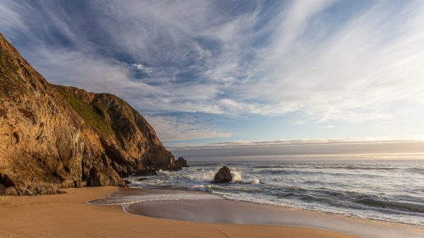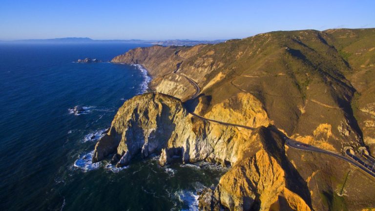
Edge-of-the-world views, gardens of coastal flowers, and aquamarine waters teeming with sea life exemplify the immense beauty found at Devil’s Slide Trail. The cliffside promenade is one of California’s most glorious pathways and certainly its most unique. The coastal trail was once a busy highway and, as its diabolical name implies, it wasn’t always so beloved.
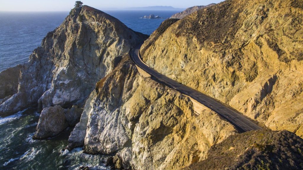
For nearly a century, the treacherous thoroughfare along the sheer cliffs of San Pedro Mountain confounded motorists, railroads, and engineers. Frequent landslides would batter the road forcing it closed for up to months at a time. In 2013, two state-of-the-art tunnels were built to bypass Devil’s Slide and, soon after, the infamous stretch of road was converted into a spectacular public trail. Today, families, nature lovers, cyclists, and equestrians can explore dazzling coastal cliffs along the paved 1.3 mile trail and experience what car-bound motorists never could. In just two years, Devil’s Slide trail has become the most popular destination in the San Mateo County Parks system drawing visitors with its grand-scale splendor.
A QUICK GEOLOGY LESSON
What is the source of the instability— and ensuring headaches—at Devil’s Slide? Sedimentary rock. The actual slide area is comprised of what was once the ocean floor, with visible layers of mud and sand, uplifted over millennia by shifting tectonic plates. Due to its mudstone content, sedimentary rock is extremely weak and prone to crumble. It’s this fragile composite that earned Devil’s Slide its notorious moniker.
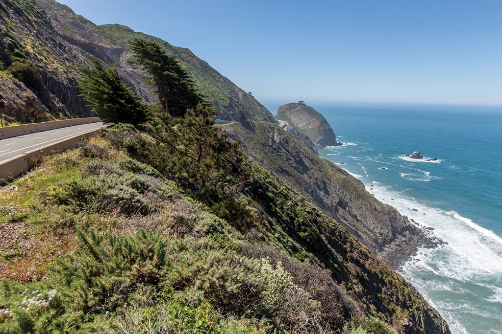
Unlike visitors who view Devil’s Slide Trail as a peaceful respite, geologists consider it a dynamic site of violent upheaval. The trail traverses two distinct, towering rock formations. Visitors can observe how the striated sedimentary rock at the north end contrasts with the solid granitic rock to the south. Identical to rock found at Lake Tahoe and Yosemite Valley, this granite was ripped from the Sierras and thrust toward the coast by forces deep within the earth. Devil’s Slide Trail lends a rare opportunity to explore sheer coastal cliffs in a safe environment and experience the earth’s continuously evolving geology.
Thanks to lush native flora, strolling between these spectacular outcrops is like walking through a hanging garden. Granite slopes are adorned with a variety of plant life such as fragrant California sagebrush, the scarlet blooms of Indian Paintbrush, and vibrant Seaside Daisies.
Practical Information
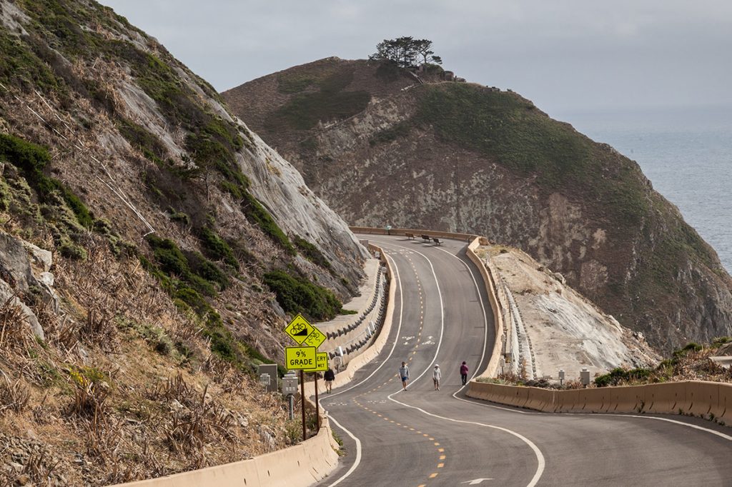
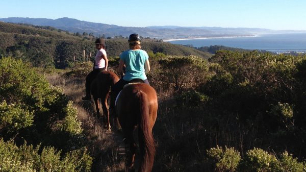
Today the Devil’s Slide Trail is part of the San Mateo Parks system and is very accessible, with parking lots at both the north and south end. On the south side there are actually two parking lots. The parking is limited though, so getting there early especially on the weekend is important. There are bathrooms, a water fountain and garbage and recycling. The pathway is fairly wide and there are lanes for bikes and for those on foot. Equestrians are allowed, though the paved road may not be ideal for horses. The path is wide and not very steep, so it is great for all levels of fitness. Bring a windbreaker or jacket in case the wind picks up, a hat to protect you from the sun, comfortable walking shoes or hiking boots and binoculars, if you have them. You may also want to bring a camera to capture the stunning views.
What You’ll See
It’s hard to imagine that the trail used to be a section of highway. It’s quiet and features gorgeous views of the ocean, with a backdrop of the cliffs and bluffs. Interpretive panels offer information about the history, geology and wildlife along the way. Birdwatchers take note: some of the birds you may see include pelicans, peregrine falcons, pigeon guillemots who nest in the cliffs, Brandt’s cormorants diving in the ocean and western gulls. Keep your eyes open for whales and seals too.
Depending upon the season, the landscape may be speckled with colorful wildflowers including California sagebrush, gum plants, blue blossom ceanothus and lizardtail, also known as seaside woolly sunflower.
Montara State Beach and McNee Ranch
A great spot to stop for a little beach time is Montara State Beach, just past the south end of the trail. Popular for beachcombers, surf fishers and tide pool exploring, the mile long beach has plenty of parking and restrooms. Dogs are allowed on leash.
Across from the beach is McNee Ranch; state park land within Montara State Beach which has several hiking trails and view trails. There are 3 trails rated “moderate”which range from a little over 3 miles to 7 miles and from 78 feet to 1,886 feet above sea level.
Food & Drink
Just about 15 minutes down the road from Devil’s Slide is Moss Beach Distillery. A landmark spot set back from the road overlooking a beautiful beach cove, it is a relaxing place with a patio where you can soak in more ocean views and enjoy a prohibition era cocktail after your hike. In addition to a full bar, the menu features plenty of seafood including clam chowder, oysters on the half shell and fish and chips. Originally opened in 1927, famed mystery writer Dashiell Hammett not only spent time here, but used it as a setting for one of his short detective stories, “The Girl with the Silver Eyes.” Rumored to be haunted by a ghost, it is a truly haunting spot.