The Coastside is blessed with a variety of natural settings, from sandy ocean beaches to old ranch lands. Trails lead you along dramatic ocean bluffs, through wetlands teeming with wildlife, and under serene redwoods.
On the Coastside, you can also stroll through three historic towns: Half Moon Bay, Princeton-by-the-Sea, and Pescadero. The Coastside invites everyone – hikers, bicycle riders, horseback riders – to explore its trails. One hint: our magnificent Coastside weather is changeable, always carry a jacket on the trails.
Devil’s Slide Trail
0.8 MILES, 1 WAY, MODERATE. GOOD FOR: HIKING, BIKING, ON-LEASH DOGS.
Trail adjacent to the Devil’s Slide Tunnel. This trail is flat at the southern parking lot with a moderate uphill climb going north and then a moderate downhill slope to the north parking lot. Park at either end. (view on Google Maps)
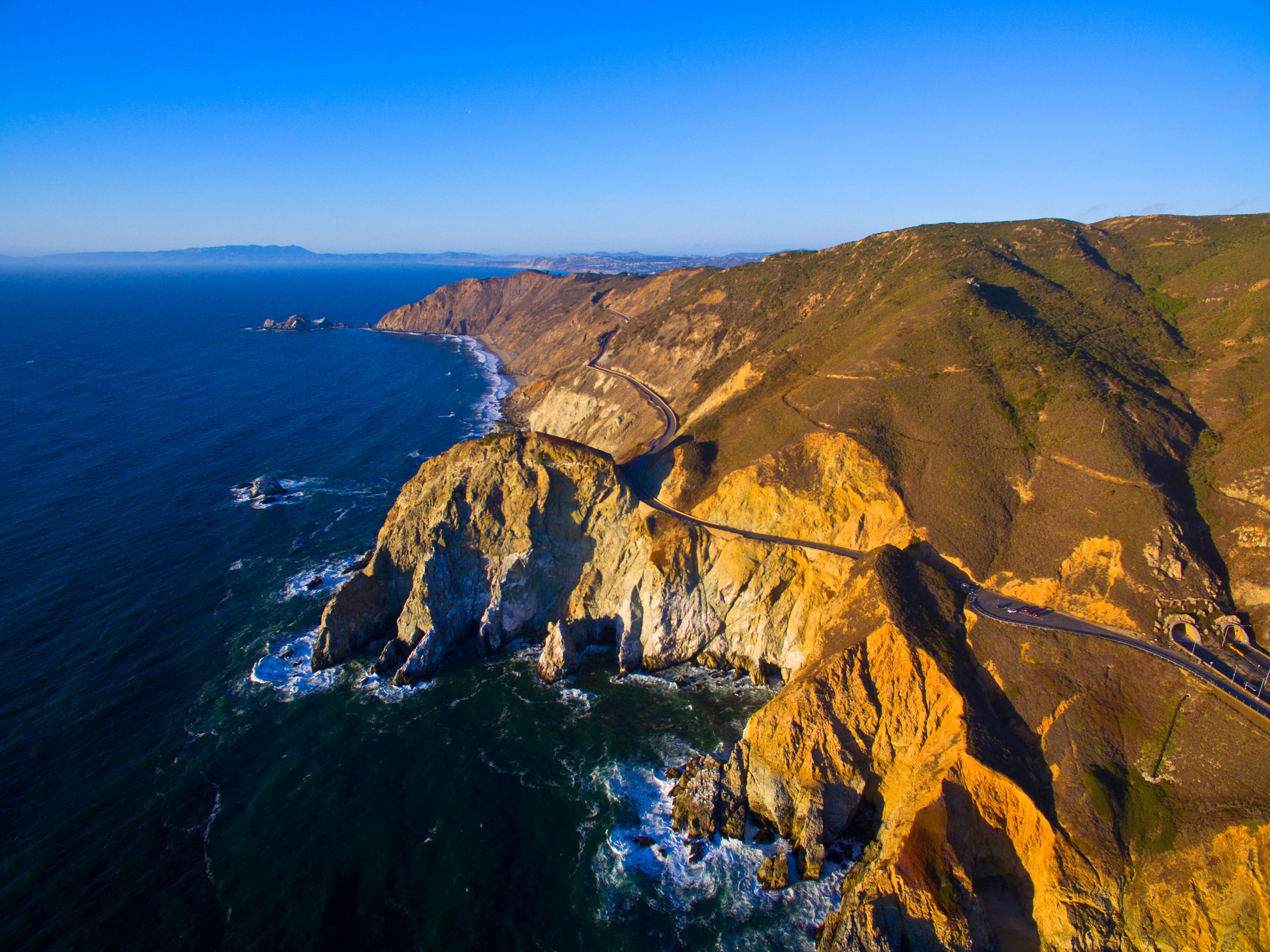
Devil’s Slide Trail offers a hike with magnificent views following the old Highway One road. From this trail overlooking the Pacific Ocean, one can see a myriad of sea life and migrating birds. There is interpretive signage and observation scopes above the rocky cliffs. The trail is good for hikers and bikers, is paved with directional lanes for each, and provides benches and lookout points overlooking one of the most scenic coastlines of California.
Ocean and Mountain
1 MILE, 1 WAY, MODERATE. GOOD FOR: HIKING, BIKING, HORSES.
Gray Whale Cove Trail in McNee Ranch State Park. The trail is flat once you climb the gentle slope from the parking lot. Park at Gray Whale Cove State Beach on the inland side of Highway One, 1.4 miles north of La Costanera Restaurant in Montara. (view on Google Maps)
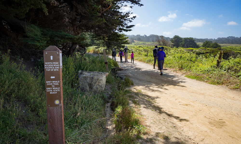
A hike on Gray Whale Cove Trail will take your breath away. Below you, the Pacific Ocean crashes against granite outcrops. To the north, looms gray-green San Pedro Mountain and inland hulks pristine Montara Mountain.
California coastal scrub vegetation lines the trail. Look for the gray-green thread-like leaves of coast sagebrush and the bright green, coarsely toothed leaves of coyote bush. Watch out for poison oak, which has three shiny reddish-green leaves.
Gray Whale Cove Trail is one of the best places on the Coastside to see masses of spring wildflowers such as blue Douglas irises, bright pink wild hollyhocks and glistening yellow buttercups.
MountainTop Views
4 MILES, 1 WAY, MODERATE. GOOD FOR: HIKING, BIKING, HORSES, ON-LEASH DOGS.
North Peak Access Trail in McNee Ranch State Park. Park at the North Peak Access Road on the inland side of Highway One, a half mile north of La Costanera Restaurant in Montara. (view on Google Maps) If this small lot is full, you can also park at Gray Whale Cove (featured above) and follow the Gray Whale Cove Trail for a mile until it meets the North Peak Access Trail.
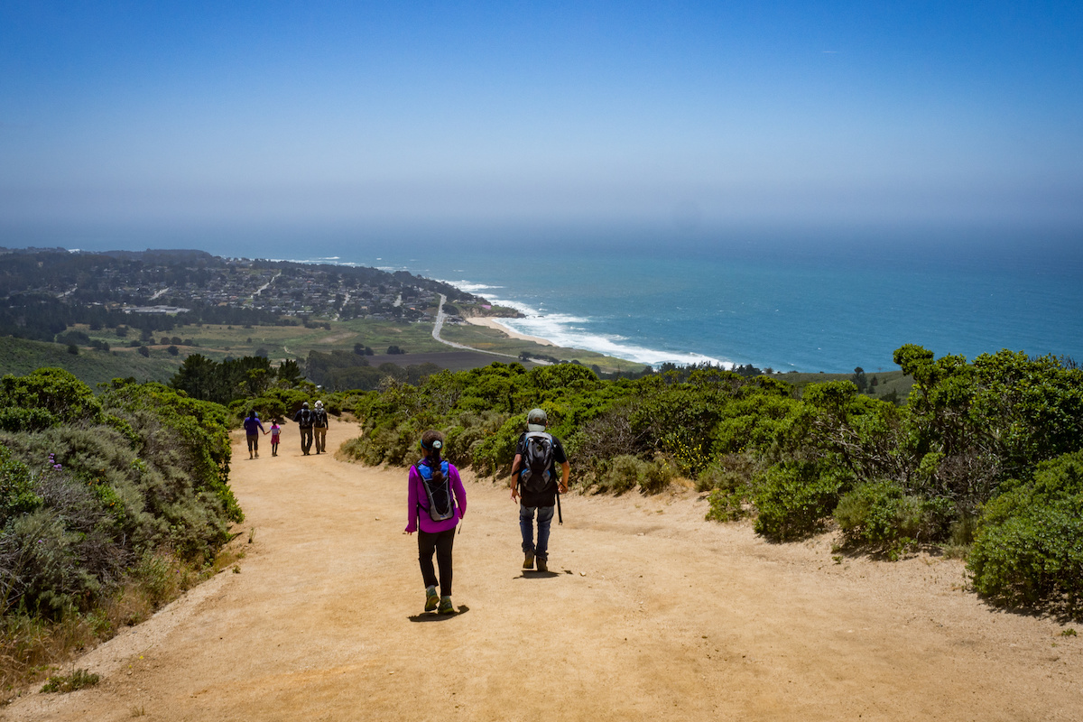
If you’re up to challenge of the 1800 foot climb up Montara Mountain, you’ll be rewarded with 360 degree views of the Bay Area. On a clear day, you can see the peaks of Mount Tamalpais and Mount Diablo, as well as the Golden Gate Bridge. In fact, Spanish Explorer Gaspar de Portolà’s expedition first sighted the San Francisco Bay when they crossed this same mountain in 1769.
While the trail is wider and better maintained than it was in Portolà’s day, it’s quite steep in some sections, so inexperienced hikers may disagree with it’s “moderate” difficulty rating, but most find the views to be worth the climb. You’ll find very little shade along the trail, so be sure to bring plenty of water and sunblock (coastal fog does little to protect from the sun).
Plant lovers should keep an eye out for the rare Hickman’s Potentilla, which only grows in one other place in the world, and Montara Manzanita, a species that’s unique to the mountain.
Tidepools
0.5 MILE LOOP, MODERATE. GOOD FOR: HIKING.
Fitzgerald Marine Reserve in Moss Beach. Take California Avenue off Highway One in Moss Beach. Interpretive Center and docent tours. (view on Google Maps) Check tide tables for low tide times.
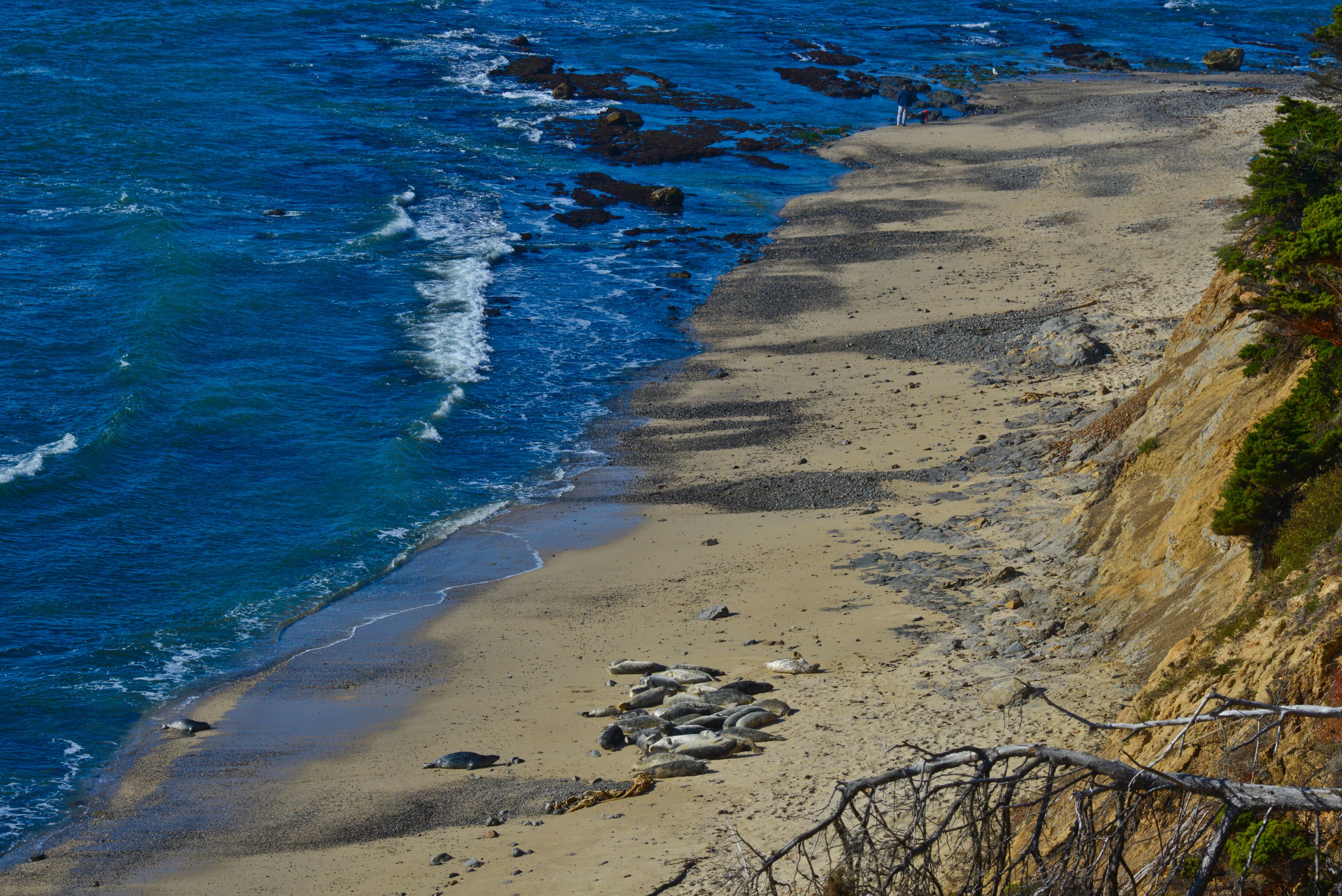
Fitzgerald Marine Reserve is THE place to marvel at the diversity of Coastside geology and aquatic life. At low tide the exposed tidepools and concentric rings of offshore rocks beckon you to explore. In quiet pools, look for hermit crabs, purple shore crab and starfish. One of the more common algae is the brown, thirty-foot-long feather boa kelp. If you look up quickly, you may catch a harbor seal watching you.
From the sheltered sandy cove at the south end of the Reserve, take the trail to the bluff tops to return to the parking lot. Walk through the tangled garden of an old estate and through a century-old forest of wind-sculpted Monterey cypress trees. In the spring, California gray whales migrate north offshore. In the summer and fall, brown pelicans skim the wave tops.
Marsh & Seashore
.5 MILES, 1 WAY, EASY. GOOD FOR: HIKING.
Pillar Point Marsh and Shoreline in Princeton-by-the-Sea. Continue past the harbor entrance to Prospect Way and turn left. Turn on Broadway, then immediately left on Harvard. Continue to the end of Harvard. Turn right on West Point Ave. Go 0.5 miles to the Pillar Point Marsh parking lot. (view on Google Maps)
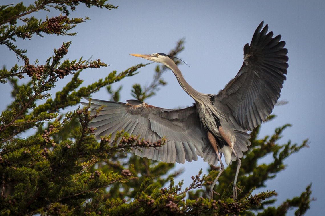
Although tiny, Pillar Point Marsh is a paradise for lucky bird watchers, who have sighted here nearly twenty percent of all North American bird species. Look for great blue herons, snowy egrets and red-winged blackbirds. This unique marsh is fed by both fresh water and salt water.
For unmatched views of Pillar Point Harbor and the Coastside, be sure to follow the trail around the point to the breakwater and tidepools on the far side. California sea lions bask on the jagged offshore rocks. Surfers catch the famous Mavericks waves just west of Pillar Point.
The Coastal Trail
11.5 MILES, 1 WAY, EASY. GOOD FOR: HIKING, BIKING, HORSES, ON-LEASH DOGS.
The Coastal Trail is approximately 11.5 miles from when done in its entirety from start to finish. You can start at either end, north at the Dardanelle Trail at Cypress Ave in Moss Beach, or south at the Cowell Ranch Trail south of Miramontes Point Road, Half Moon Bay. There is currently no trail through Princeton Harbor, but one can walk on the roads and sidewalks. (view on Google Maps)
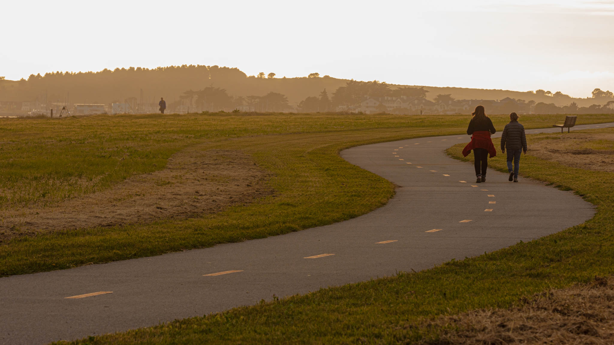
The Coastal Trail will hopefully one day be contiguous between Canada and Mexico. The Half Moon Bay Coastside has done a great job of filling in most of the expanse along this portion of the San Mateo County coast. Walk all or part of this magnificent trail with some of the most spectacular coastal views of the state. You will encounter countless birds, sea life, and wildlife along the way. Frenchman’s Creek Bridge and the John Hernandez Bridges cross picturesque creeks, enjoy cypress trees, and a eucalyptus grove among the sites. Golden orange California poppies, bright yellow beach primroses and pale yellow bush lupines line the trail. White-crowned sparrows sing from the top of nearly every coyote bush. Brush rabbits nibble along the trail’s edge. You may even see a long-legged, long-eared jack rabbit bound across your path.
Old Ranch Lands
1 MILE, 1 WAY, EASY. GOOD FOR: HIKING, BIKING, HORSES.
Mill Creek Ranch Road in Burleigh Murray State Park. Take Highway One south of Half Moon Bay for about 1 mile. Turn left (east) on Higgins Purissima Road. Notice the historic James Johnston House on your right. Continue for 1.6 miles to the marked parking lot on left side of road. (view on Google Maps)
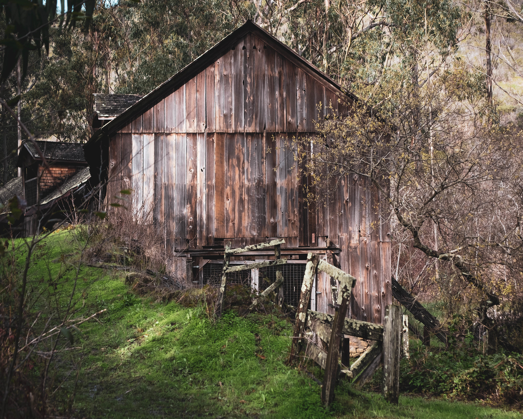
To step into the Coastside’s agricultural past, visit tranquil Burleigh Murray State Park. At the end of Mills Creek Ranch Road is a barn like none you have never seen before. Built into the side of a hill, the long, two-story dairy barn curves along the slope on a stone foundation. This century-old barn, which combines English and Italian architectural features, may be the only one of its kind in California. It is listed in the National Register of Historic Places and is currently undergoing restoration.
Past the barn, Mills Creek Ranch Road dwindles into a verdant creekside trail, which continues for about one mile. Mills Creek, which flows year-round, is lined with red alder, flowering currant and twinberry. The ancient pillar-like blue gum eucalyptus trees are especially impressive.
Redwoods
1.25 MILES, 1 WAY, EASY TO MODERATE. GOOD FOR: HIKING, BIKING, HORSES.
Purisima Creek Trail in Purisima Creek Redwoods Open Space Preserve. Take Highway One south of Half Moon Bay for about 1 mile. Turn left (east) on Higgins Purisima Road. Continue for 4.4 miles to the small, unmarked parking lot at the sharp bend in the road. (view on Google Maps)
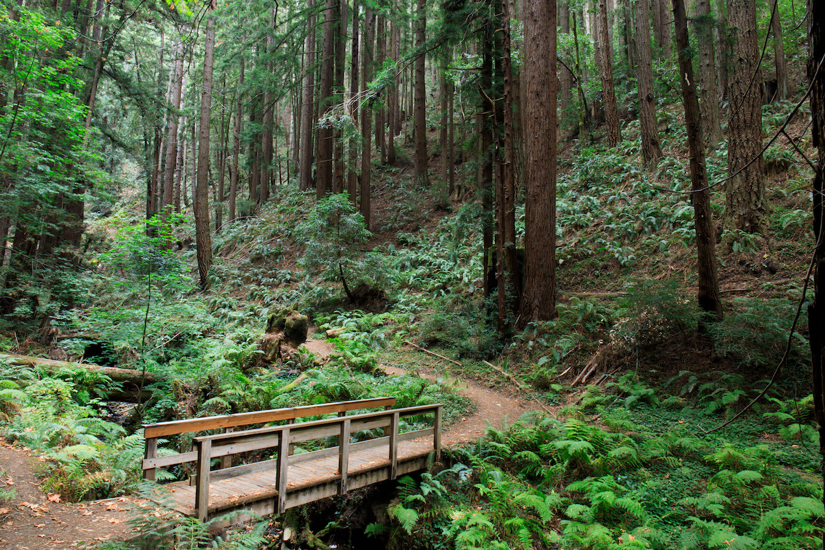
A gentle broad trail dappled with sunlight and shadow beneath coast redwoods beckons you through the Purisima Creek Redwoods Preserve. Go as far as the bridge over the year-round creek-or up the steep canyon to Skyline Boulevard three miles beyond. The serene grove at the trailhead has some of the tallest redwoods in the Preserve. Most of the redwoods are second growth, much the original first-growth forest was logged in the late 1800’s. Look for big leaf maples and red alders along the way.
The varied floral blue of forget-me-knots, hedge nettles and periwinkles greet you at the trailhead. Further on, sword fern, five finger fern and wood fern cascade from the bank of the trail.
Pocket Beach
1 MILE, 1 WAY, EASY. GOOD FOR: HIKING, BIKING.
Cowell Ranch State Beach. Take Highway One south of Half Moon Bay 3.3 miles. Park at the marked parking lot. (view on Google Maps)
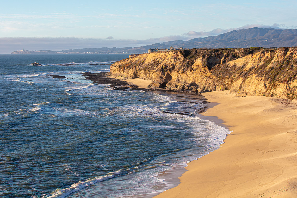
A pocket beach brings to mind secluded privacy, which you’ll certainly discover at Cowell Ranch State Beach. Over one-hundred steps lead from the trail’s end to a delightful quarter-mile-long sandy cove, walled in by precipitous sandstone ridges.
If the prospect of so many steps is daunting, then aim for the benches at the bluff top overlook. Ninety feet below, harbor seals bask on protected offshore rocks. You may glimpse newborn pups in March. Summer months bring brown pelicans gliding serenely along the bluff tops. Some say this is how the Northern California coast looked a hundred years ago.
Bird Refuge
1 MILE, 1 WAY, MODERATE. GOOD FOR: HIKING.
Sequoia Audubon Trail in Pescadero Marsh Natural Preserve. Take Highway One south of Half Moon Bay for 16 miles. Park at the marked parking lot (south end of Pescadero Creek Bridge). Docent-led tours every Saturday at 10:00 AM and every Sunday at 1:00 PM, weather permitting. (view on Google Maps)
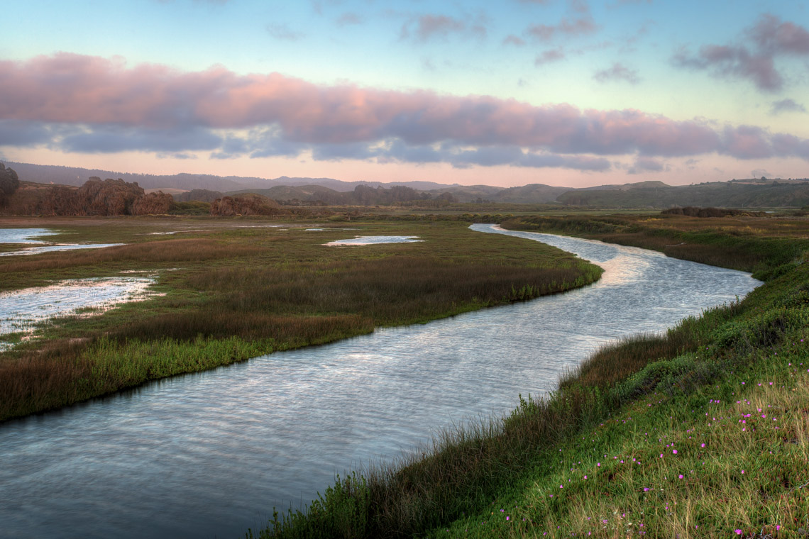
Pescadero Marsh is on the Pacific Flyway. Every year thousands of birds (nearly two hundred species) rest and feed here. Great blue herons nest in the northern row of blue gum eucalyptus trees; great egrets and snowy egrets stalk the shallows, and northern harriers glide over the meadows. The best bird watching times are in late fall and early spring. The trail leads you along an old dike between marsh lands and the musical rattle of marsh wrens accompanies your every step. Pescadero Marsh is one of the most important remaining wetlands on the California coast.
Rocky Beach, Open Ocean
1 MILE. ONE WAY. MODERATE. GOOD FOR: HIKING, ON-LEASH DOGS.
Bean Hollow Beach Trail between Bean Hollow State Beach and Pebble Beach. Take Highway One south of Half Moon Bay for 18 miles. Park at Pebble Beach (marked) or Bean Hollow State Beach (marked). (view on Google Maps)
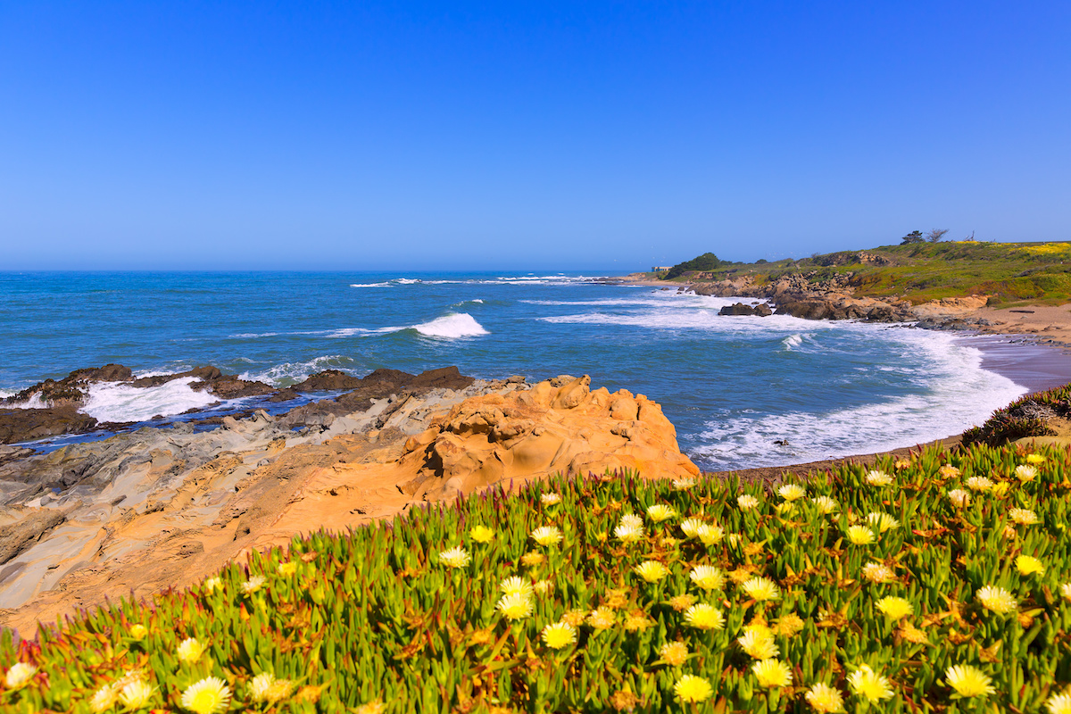
Spectacular Bean Hollow Trail leads you between two geologically interesting, surf-splashed beaches. At Bean Hollow State Beach, trace the lacy mazes on the eroded sand-stone rocks. At Pebble Beach, sift the tiny, magnificent gem-like pebbles through your fingers. In the late 1800’s, tourists came from all over to gather pebbles at this beach. Now, pebble gathering is strictly prohibited.
The narrow bluff trail crosses six bridges to show you harbor seals basking on the offshore rocks and magnificent coastal plants such as sea pinks. Seaside daisies, bush lupines and Hooker’s primroses.
Marine Wildlife Refuge
1.5 MILES. ONE WAY. MODERATE. GOOD FOR: HIKING.
Año Nuevo Point Trail in Año Nuevo State Reserve. Take Highway One south of Half Moon Bay for 27 miles. Turn right at well-marked park entrance. (view on Google Maps)
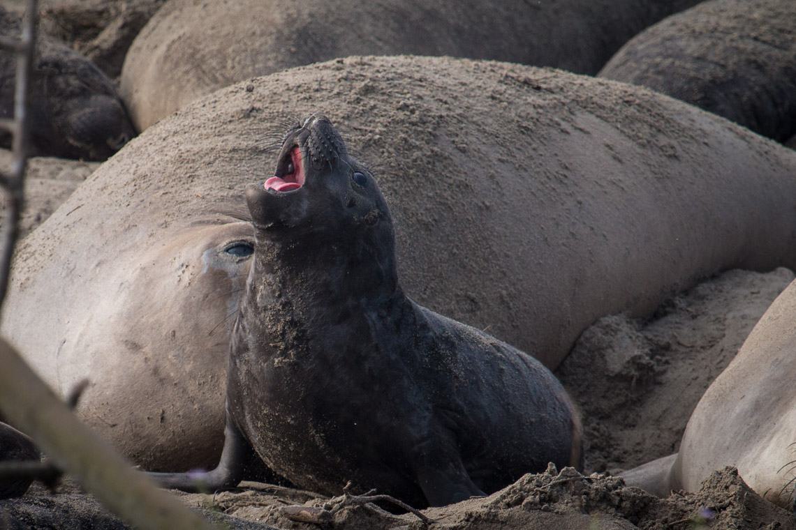
From December to March, elephant seal guided tours are by reservation only. From April to November, hiking permits for Año Nuevo Point Trail are issued at entrance gate on first come, first-serve basis. Note: Pond Loop Trail and Cove Beach Trail are open year-round and do not require hiking permits.
A hike along Año Nuevo Point Trail from the old grazing lands to the sandy, windy point is unforgettable. At the point you can observe all the stages in the life of a northern elephant seal-from birth (in January) to adulthood. Around you, plants-yellow lizard tail, blue sea rocket and yellow sand verbena- stabilize the active dunes. Overhead soar western gulls, northern harriers and black-shouldered kites. From Año Nuevo island offshore come the characteristic barks of California sea lions.
Everyone comes to Año Nuevo State Reserve to see the elephant seals, who are present nearly year-round. Between April and August, they come ashore to molt. Between December and March, they come ashore to give birth and breed.
